About Aquifer Vulnerability Maps

Aquifer Vulnerability
The vulnerability of an aquifer is a measure of its risk of contamination. Aquifer vulnerability is determined by combining susceptibility ratings with human sources and natural sources of contamination. Vulnerability therefore differs from aquifer susceptibility, which considers only the physical factors
that affect flow into and through an aquifer, without regard to threats to ground water from human sources or natural sources of contamination.
Vulnerability (risk) typically is greater where human development occurs, especially on the recharge area of an aquifer or near creeks upstream from sinkholes. Examples of development can include roads and streets, homes, septic systems, industrial activities, agricultural activities,
and mining. When factors such as these are combined with a high susceptibility rating, the result typically is a high vulnerability of the aquifer to contamination.
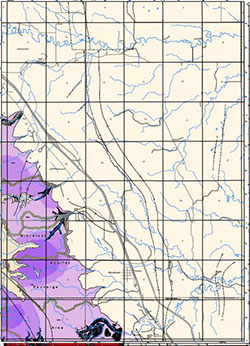
The map at the left shows the outcrop of the Madison aquifer with various colors that indicate ratings of its vulnerability. These ratings depend on the following factors: 1) the aquifer’s very high susceptibility, and 2) roadways, homes with septic systems, and other human factors that vary
from place to place
.