Aquifers-Introduction
An aquifer is a body of saturated rock through which water can easily move. Aquifers must be both permeable and porous and include such rock types as sandstone, conglomerate, fractured limestone and unconsolidated sand and gravel.
Glossary of Ground-Water Terms
General Ground-Water Studies in the Black Hills
South Dakota Mines Aquifer Mapping Project: South Dakota School of Mines and Technology and the West Dakota Water Development District
The Black Hills Aquifer Mapping Project has produced two types of studies relating to ground water in Pennington and Custer Counties. The first of these defined areas of potential aquifer vulnerability and susceptibility in sedimentary aquifers. The
area of study covered nine geologic quadrangles (7.5 minute topographic quadrangles) in Pennington County along the eastern flank of the Black Hills. The second, consisting of two parts, examined the quality of ground water in the crystalline aquifers
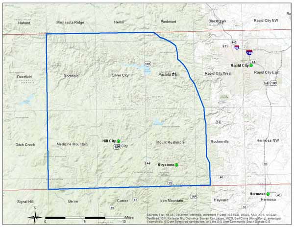
in six quadrangles in the core of the Black Hills in Pennington County and a much smaller area surrounding the city of Custer.
The study of the sedimentary aquifers was undertaken to determine and to evaluate the aquifer vulnerability and susceptibility of their recharge areas. Four aquifers, from oldest to youngest the Deadwood Formation, the Pahasapa Limestone (also called
the Madison Limestone), the Minnelusa Formation, and the Inyan Kara Group, were examined. Five map types were prepared for each aquifer. This began with preparation of a geologic map from which others detailing structure contours (elevations), depth-to-aquifer,
aquifer vulnerability, and aquifer susceptibility were derived.
In the crystalline aquifers (composed of Precambrian schist, granite, quartzite, etc.) water quality was the focus. Samples were taken from individual home sites and analyzed for arsenic, iron, nitrate, sulfate, hardness, coliform bacteria, and fecal
coliform bacteria. The results showing the areas (Pennington County and Custer) are presented as “report cards” for each of the contaminants.
Aquifer Map Types
Geology
A Geologic map shows the locations at which individual rock sequences, e.g., the Harney Peak Granite or the Pahasapa Limestone (Madison Limestone), are present at the Earth’s surface. All rock units within the area of the map are included and are shown
by color or patterns.
A Depth to Formation map shows the depth of the top of the aquifer below the earth's surface. It gives the estimated depth that one would need to drill to hit the aquifer. These depths are approximate only, with uncertainties of 50-100 feet or higher.
A Structure Contour map shows the elevation of the surface of the aquifer relative to sea level. It is like a topo map of the top of the aquifer, and allows you to see geologic structures such as folds or faults.
An Aquifer Susceptibility map reflects the innate ability of an aquifer to transmit water and contaminants from the surface into the aquifer, based on the rock type and other properties such as fracturing and porosity.
An Aquifer Vulnerability map highlights sensitive regions where aquifers are at especial risk due to their susceptibility and the potential for man-made hazards such as faulty septic systems or contaminant spills.
Water quality in this study defines the chemical (e.g. hardness, arsenic, etc.) and biological (coliform bacteria) qualities of ground-water.
Download Maps

Water Quality Studies
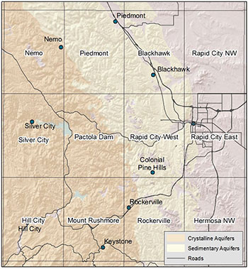
The Water Quality project is testing water wells to acquire baseline information about water quality in the metamorphic and igneous rocks (crystalline aquifers, brown in the figure above) in the central Black Hills. Participation is voluntary, and homeowners
receive a copy of the test results. Results from the three years of sampling (2013-2014-2015) targeting the central Black Hills is complete.

View results for the Water Quality Studies
Publications related to this project
This project is being funded by the West Dakota Water Development District. We would also like to thank the South Dakota Geological Survey and the South Dakota Department of Transportation for sharing GIS data for the project.